 |
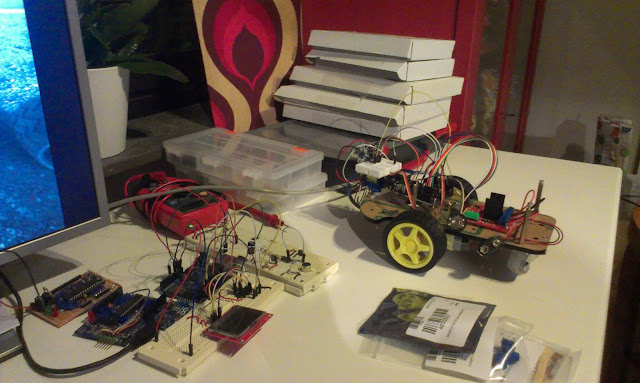
| To the left 2 homemade Arduino boards. In the center a microphone circuit with LCD. To the right "Flip" the robot. |
"Flip" - the robot
Flip is my mapping Arduino robot. The goal to make a map of a room. Flip needs to know where he is and in what direction in order for the mapping to work. The idea is that Flip should navigate relative to a set of "radio beacons" that allows us to determine his position from their known positions by trilateration.
The mapping is done using a Sharp IR sensor on a micro servo.
The mapping is done using a Sharp IR sensor on a micro servo.
 |
| To the left a top down view of obstacles. To the right the obstacles as Flip sees them through the IR-sensor. |
Features
- Arduino
- 2WD Robot with H-Bridge from dx.
- Sharp IR-Distance sensor for mapping (GP2Y0A02YK0F)
- 433Mhz radio sender and transmitter shield
- Speaker
Todo:
- Needs to be drilled for new holes for both the Arduino and the H-bridge.
- Test the electronic compass circuit
- Determine the error rates for measurements
The radio beacons
These emit a radio signal to the robot who responds with a sound. Distance is calculated and should be sent to the Raspberry Pi for trilateration.
 |
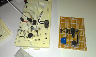
| Microphone circuits |
 |
| The incoming sound is recorded and distance is calculated by finding the start of the specific frequency 4800Hz |
Features:
- 433Mhz radio
- LM386 Amplifier circuit
- Electret microphone 1 of 3 soldered
Todo:
- Solder those microphones circuits * 2
- Try other frequencies
- Test band pass filter
http://en.wikipedia.org/wiki/High-pass_filter (try software impl first) - Enable battery powering(solve the noise problems)
- Multiple short noises and select best or median
- Test external ADC (ordered)
- Try longer distances (now 2m max) the problem is the size of buffer
The Raspberry PI brain
The R-Pi should be connected by radio to the robot and to the radio-beacons.
It should receive the measurements and sensor readings. The location from the radio beacons, direction from the compass circuit and obstacle mapping from the robots IR-sensor will be used to build a map.
I really have not started with this yet but I think I will use java to read the values from the GPIO serial port and store every mapping measurement in an database. From that database a statistical model can be used to build a map. This is a ongoing research field and here is a good document that tells us about some techniques.
 |
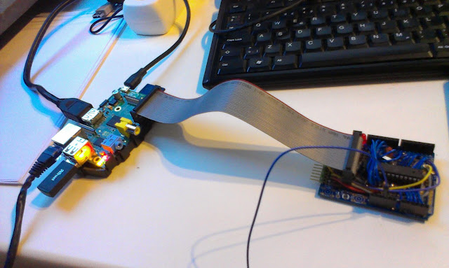
| The R-Pi with an custom made Arduino that can communicate and be programmed directly from the GPIO. |
Features
- Raspberry Pi Model B with WiFi, Raspian OS.
- Arduino board that can be programmed directly from the GPIO
Todo:
- The Arduino should be programmed without the reset button be pressed.
- Java code that stores the measurements in a database
- Another radio shield should be soldered.
- A way of communicating with the radio beacons must be found. Wire might disturb the sensitive microphones as experienced.
No comments:
Post a Comment